


Cowboy Trail
 Launch the media gallery 1 player
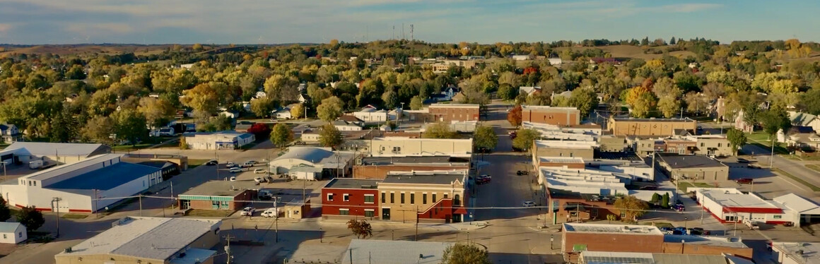
Start your Cowboy Trail adventure in Neligh.
The trail runs directly through the community, offering immediate access to one of Nebraska’s most unique outdoor experiences. Stretching nearly 195 miles from Norfolk to Valentine, this converted railroad corridor provides a smooth, scenic route for biking, walking, and horseback riding.
Why Ride the Cowboy Trail in Neligh?
Neligh is a natural stop along the trail, offering the perfect blend of small-town hospitality, essential amenities, and scenic access to the Elkhorn River corridor.
- Direct trail access within city limits
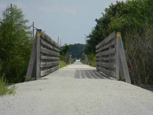
- Spine-friendly crushed limestone surface ideal for all skill levels
- Wide-open landscapes with minimal grade (generally 2% or less)
- Multi-use trail for biking, walking, and horseback riding
- Part of the Great American Rail Trail system
With communities spaced every 10–15 miles, riders can easily plan stops for food, rest, and overnight stays along the route.
Trail Distances from Neligh
Planning your ride? Neligh sits near the center of the Cowboy Trail, making it an ideal starting point, rest stop, or overnight destination.
Approximate distances from Neligh:
- Oakdale – ~5 miles east
- Tilden – ~12 miles east
- Norfolk – ~31 miles east
- Clearwater – ~9 miles west
- Ewing – ~21 miles west
- O’Neill – ~40 miles west
- Valentine – ~150 miles west
Distances are approximate and follow the Cowboy Trail corridor. Riders should check the official Nebraska Game and Parks Cowboy Trail map and current trail conditions before planning longer routes.
Trail Details
- Length: ~195 miles (Norfolk to Valentine)
- Surface: Crushed limestone with some concrete segments
- Terrain: Flat, gradual grade (former railroad line)
- Best for: Hybrid bikes, mountain bikes, and casual riders
- Trail Use: Hiking, biking, horseback riding
- Trail Hours: Sunrise to sunset
Plan Your Stop in Neligh
Make Neligh your basecamp or overnight stop while exploring the Cowboy Trail:
- Riverside Park – Camping, showers, Wi-Fi, and direct trail access
- Fred Penn Park – Additional camping and recreation space
- Downtown Neligh (Old Mill District) – Walkable dining, shopping, and historic charm
- Neligh Mill State Historic Site – A unique stop just off the trail
The trail runs alongside the Elkhorn River through Neligh, creating one of the most scenic and accessible segments in the region.
Know Before You Go
- Bring extra tubes—natural sandburs can occasionally puncture tires
- Stay on designated trail areas and respect private property
- Yield appropriately: cyclists → pedestrians → horseback riders
- No motorized vehicles allowed
Trail Map & Conditions
Before you ride, check current trail conditions and plan your route using official resources from the Nebraska Game and Parks Commission.
- Official Cowboy Trail Map & Information – View trail segments, access points, and community connections
- Trail Conditions & Closures – Stay up to date on maintenance, weather impacts, and temporary closures